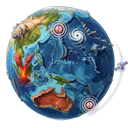
Where is the Earth shaking now?
This map shows current earthquakes from the LiveGlobe backend. Color follows magnitude: blue for smaller quakes, yellow-orange for medium quakes and red for strong quakes. In LiveGlobe 3D it becomes a 3D experience with sources, USGS links, news and more natural events.
Install it because a quake is more than a dot.
The web map quickly shows where the Earth is shaking. The app goes further: rotate the 3D globe, jump to regions, compare earthquakes with volcanoes, storms, weather and climate layers, and open related USGS sources or news in context.
- 01
Earthquakes in spatial context
On the 3D globe, patterns along plate boundaries, island arcs and mountain belts are easier to understand than in a flat list.
- 02
USGS and news one step away
The app can take you from an event to deeper sources such as USGS and to relevant news when magnitude and place are not enough.
- 03
Not just earthquakes
LiveGlobe 3D connects quakes with volcanoes, storms, wildfires, wind, clouds, weather and climate layers on the same Earth.
- 04
Better for curiosity and teaching
Rotate, zoom, compare and present current natural events without jumping between separate pages.